


North Georgia has some of the prettiest hiking in the Southeast, and we get to enjoy it every single day. At Blue Creek Cabins, we have been welcoming guests to Helen since 2002, and one of the first things our visitors ask is always the same: where should we hike?
The good news is that you do not have to drive far to find a great trail. Some of the top hiking trails in North Georgia start within a short drive of our cabins, and they range from easy paved paths to serious summit climbs. Waterfalls, mountain views, old logging roads through cove forest: the variety is what makes this region special.
We put together this guide from our own trips, guest recommendations, and years of pointing people toward the best spots. Whether you want a stroller-friendly stroll or a bucket-list summit, you will find your match below.
Why North Georgia Is a Hiker’s Paradise
The Chattahoochee-Oconee National Forest covers more than 850 miles of trails, and it is right in our backyard. That means everything from short waterfall walks to a real slice of the Appalachian Trail is within easy reach of Helen.
The mountains here are older and more rounded than out west, which makes them approachable. You get big views without needing technical gear, and the streams that carve through the ridges create a steady lineup of waterfalls, pools, and mossy coves. Fall foliage is world class, spring wildflowers are stunning, and even in the heat of summer the higher elevations stay comfortable in the shade.
Most of the trails we recommend are on public land managed by the U.S. Forest Service or Georgia State Parks, so they are well signed and mapped. A few require a small parking fee, but most are free to enjoy.
Best Waterfall Hikes Near Helen
If you can only pick one theme for your trip, make it waterfalls. This corner of Georgia has more of them per square mile than almost anywhere in the state, and most of the trails to reach them are short enough for a morning outing.

Anna Ruby Falls
Anna Ruby Falls is the classic North Georgia waterfall walk, and it is the one we send first-time guests to more than any other. The trail is paved the whole way, which makes it doable for strollers, grandparents, and anyone easing into hiking.
At the top you get a double waterfall where Curtis Creek drops about 153 feet and York Creek drops another 50 feet, meeting at the base into Smith Creek. Two viewing platforms let you get close without getting wet.
- Rating: 4.8 stars (1,522 reviews)
- Distance: about 0.9 miles round-trip, paved and uphill
- Difficulty: easy to moderate (steady grade)
- Address: Anna Ruby Falls Rd, near Helen, GA
- Access: through Unicoi State Park; small day-use fee at the falls entrance
View Anna Ruby Falls on Google Maps

Raven Cliff Falls Trail
Raven Cliff is our pick when guests want something longer and a little wilder. The trail is inside the Raven Cliffs Wilderness and follows Dodd Creek the entire way, passing several small cascades before ending at the main event: a dramatic waterfall that splits a towering cliff face.
We love it in spring for wildflowers and in early summer when the creek is running full. Bring good shoes. There are roots, rocks, and a couple of scrambly bits near the top.
- Rating: 4.8 stars (1,262 reviews)
- Distance: about 4.9 to 5 miles round-trip
- Difficulty: moderate (gentle grade, but long enough to feel it)
- Address: 3000 Richard B Russell Scenic Hwy, Cleveland, GA 30528
- Access: America the Beautiful passes accepted; standard day-use pass otherwise
View Raven Cliff Falls on Google Maps

Dukes Creek Falls
Dukes Creek Falls is one of the most photogenic waterfalls in the area, and the trail is shorter than Raven Cliff which makes it perfect for a half-day outing. You start at a well-signed recreation area right off the Richard B Russell Scenic Highway, and the path winds down through mossy hardwoods to a series of viewing platforms.
The falls drop in stages, about 150 feet total, at the meeting point of Dukes Creek and Davis Creek. It is one of the few trails where you can hear the water almost the whole way in.
- Rating: 4.8 stars (330 reviews)
- Distance: about 2 miles round-trip
- Difficulty: easy going down, moderate coming back up
- Address: 1699 Richard B Russell Scenic Hwy, Helen, GA 30545
- Good for: families, dogs on leash, quick outings
💡 Local tip: From the trailhead parking, look southeast for a clear view of Yonah Mountain. It is a nice bonus before you even start hiking.
View Dukes Creek Falls on Google Maps
DeSoto Falls
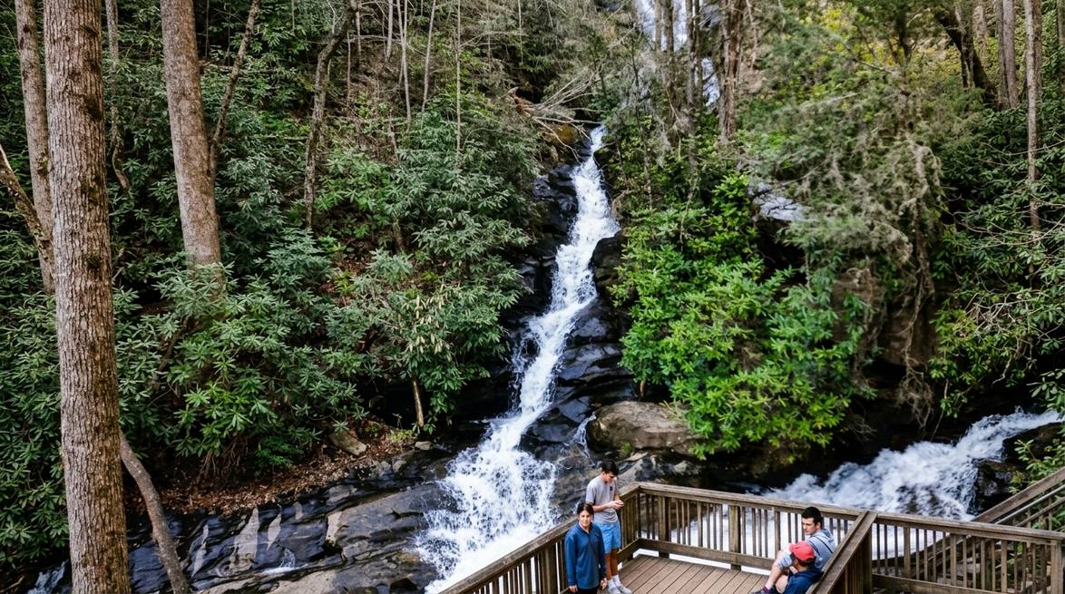
DeSoto Falls is a favorite for guests who want a real waterfall hike without a big commitment. The trail follows Frogtown Creek through a shaded corridor of old pines and rhododendron, ending at two separate cascades: a lower falls and an upper falls, each with its own viewing area.
The area is named for Spanish explorer Hernando de Soto based on local lore that artifacts from his expedition were found nearby. We cannot verify the history, but the story adds a nice layer to the walk.
- Rating: 4.6 stars (557 reviews)
- Distance: about 2.2 miles round-trip
- Difficulty: easy (well-graded, well-maintained)
- Address: 18365 US-129, Cleveland, GA 30528
- Good for: dogs on leash, families with kids
View DeSoto Falls on Google Maps

Helton Creek Falls
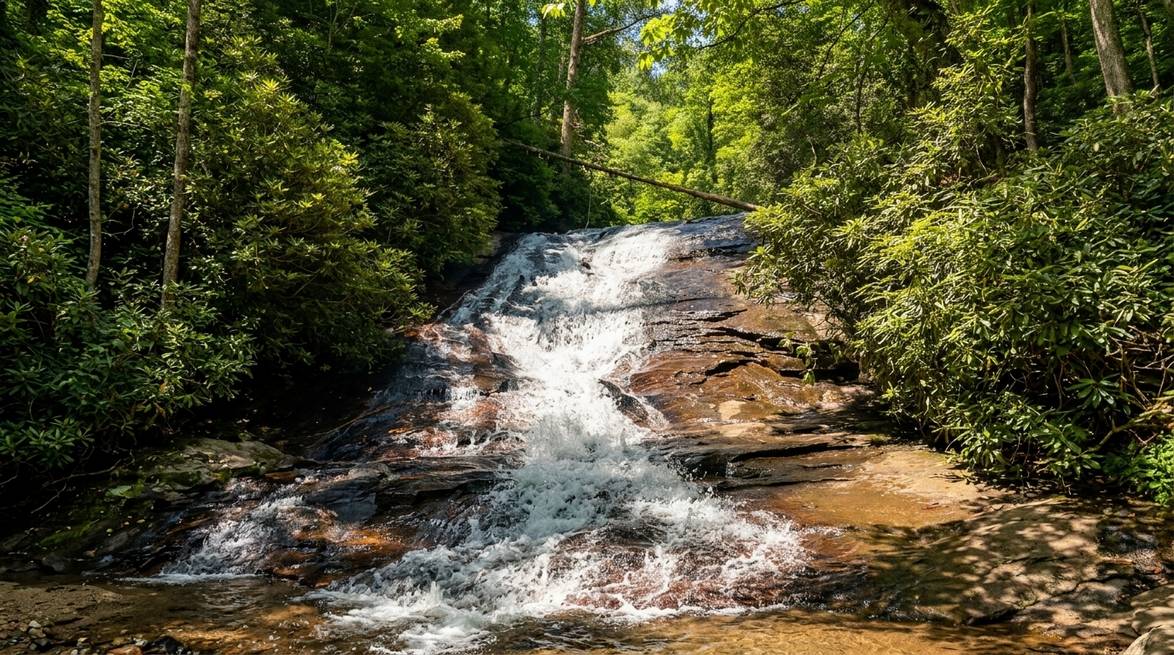
Helton Creek is the shortest waterfall walk on this list and one of the most rewarding. It is a quick jaunt from a small forest parking area to a series of cascades with a wide pool at the base. Kids can wade in the shallow water on the lower falls, and the upper falls have a small platform for photos.
- Rating: 4.8 stars (319 reviews)
- Distance: under 1 mile round-trip
- Difficulty: easy
- Address: Helton Creek Rd, Blairsville, GA 30512
- Best for: families, quick photo stops, hot summer afternoons
The road in is unpaved and can be rough, so a car with reasonable clearance helps. Take your time on the way there and enjoy the drive.
View Helton Creek Falls on Google Maps
Best Mountain and Summit Hikes
When you want a view, this is where you go. These hikes trade waterfall drama for wide-open ridge lines, rocky summits, and the kind of horizon that makes you forget you started the day with coffee at the cabin.
Yonah Mountain
Yonah is the signature summit hike near Helen. From the trailhead you climb steadily through hardwood forest, gaining about 1,400 feet, before popping out on open, rocky ledges at the top. On a clear day, guests have told us they can see all the way to the Atlanta skyline from the summit.
The mountain is also a training ground for the U.S. Army Ranger School, so you may see climbers on the sheer south face. It is fascinating to watch and a nice reminder to stay well behind the safety railings.
- Rating: 4.8 stars (328 reviews)
- Distance: about 4.3 to 5 miles round-trip
- Difficulty: hard (steep and rocky, especially in the top half)
- Location: Cleveland, GA area (short drive from Helen)
- Best time: fall for foliage, spring for wildflowers
💡 Good to know: The final push is on exposed rock. If it is wet or icy, save it for another day. Also pack more water than you think you need. There is no water on the trail.
View Yonah Mountain on Google Maps

Blood Mountain
At 4,458 feet, Blood Mountain is the highest peak on the Georgia section of the Appalachian Trail. The loop we recommend connects the Freeman Trail, the AT, and the Byron Herbert Reece Trail, delivering broad views and, in late spring, a spectacular display of mountain laurel and rhododendron blooms.
The old stone shelter at the summit is worth the climb on its own. Backpackers use it as a stop on the AT, and it is one of the most photographed spots on the Georgia section.
- Rating: 4.9 stars (based on wilderness listing reviews)
- Distance: about 5.8 miles as a loop
- Difficulty: moderate to hard (real climbing, sustained effort)
- Location: Blood Mountain Wilderness, west of Helen
- Trailhead: Byron Herbert Reece Memorial parking area
View Blood Mountain on Google Maps
Brasstown Bald
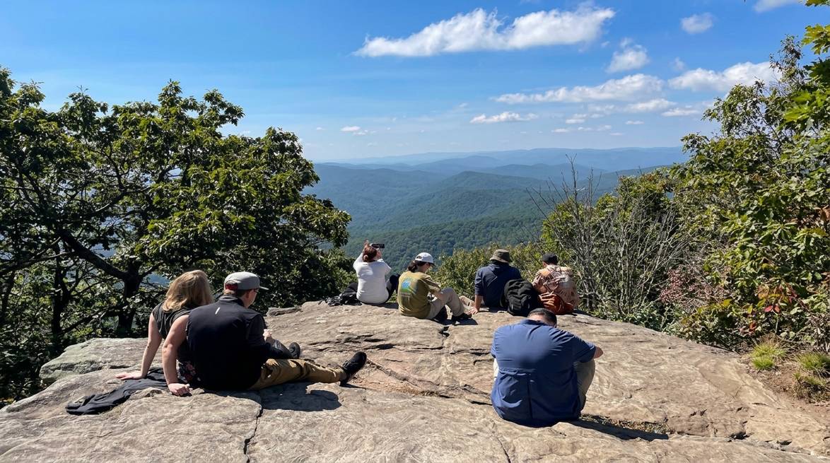
Brasstown Bald is the highest point in Georgia at 4,784 feet, and it is one of the few summits where you can get 360-degree views from a stone observation tower at the top. On the clearest days, four states are visible.
You have two choices to reach the summit: the shorter paved path from the upper parking area, or a longer trail from below for hikers who want to earn it. Either way, the visitor center at the top has excellent exhibits on the Cherokee history of the region and the Appalachian ecosystem.
- Rating: 4.8 stars (2,771 reviews)
- Distance: 0.6 miles paved from upper lot; 6 miles round-trip via Jack’s Knob Trail
- Difficulty: easy (paved) or moderate (Jack’s Knob)
- Address: 2941 GA-180 Spur, Hiawassee, GA 30546
- Parking fee: yes, and a shuttle runs seasonally from the lower lot
Local tip: Come in October for peak fall color. It is the highest point in the state, and the view of the surrounding valleys turning red and gold is unforgettable.
View Brasstown Bald on Google Maps

Amicalola Falls State Park
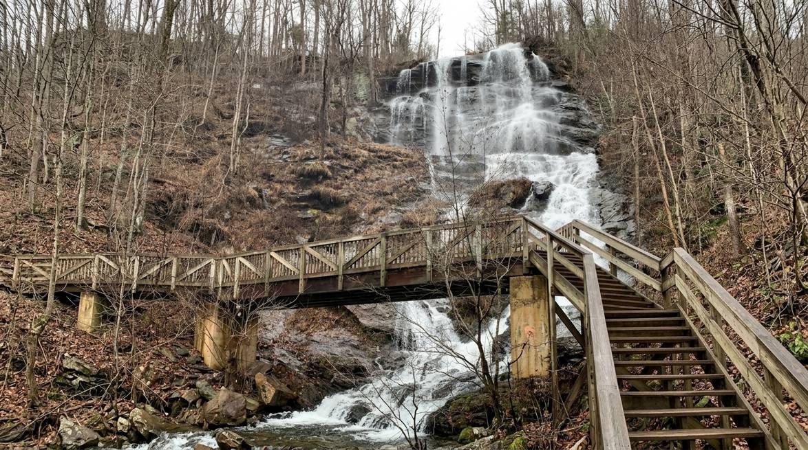
Amicalola is home to the tallest cascading waterfall east of the Mississippi, dropping 729 feet in seven levels. It is also the southern approach to the Appalachian Trail, so if you have ever dreamed about the AT, this is where the journey begins.
The park has options for every fitness level. You can drive to a view of the top of the falls, walk the paved lower trail, or tackle the 604-step Base of Falls Staircase for the full experience.
- Rating: 4.8 stars (14,504 reviews)
- Distance: 0.5 to 8+ miles depending on route
- Difficulty: easy to strenuous
- Address: 418 Amicalola Falls State Park Rd, Dawsonville, GA 30534
- Parking pass: $5 (ParkPass)
View Amicalola Falls on Google Maps
Hidden Gems and Easy Local Walks
Not every great hike has to be a marquee summit or the tallest waterfall in the state. Some of our favorites are quiet, low-crowd trails that our guests would never find on a top-10 list. These are the walks we do on our own days off.
Smithgall Woods State Park
Smithgall Woods is less than four miles from downtown Helen, and it stays remarkably quiet compared to Unicoi or Anna Ruby. The park protects a large section of Dukes Creek along with 22 miles of hiking and biking trails, and it feels like a nature preserve because that is essentially what it is. Charles Smithgall gifted the land to Georgia in 1994.
The Ash Creek Loop is our top pick here at about 3.8 miles round-trip, with gentle rolling terrain and lots of small stream crossings. Wildlife sightings are common: wild turkey, deer, and songbirds are regulars.
- Rating: 4.7 stars (951 reviews)
- Distance: 3.5 to 8.7 miles depending on route
- Difficulty: easy to moderate
- Address: 61 Tsalaki Trail, Helen, GA 30545
- Fee: small state park parking pass
View Smithgall Woods on Google Maps

Unicoi State Park
Unicoi is the state park right next door to Helen, and it is where you go for a low-stress, do-it-all outdoor day. The Bottoms Loop Trail is about 2 miles and takes about an hour, making it the perfect warm-up hike. If you want more, the Unicoi Lake Loop circles the lake with continuous water views and gentle grades.
The park also connects to Anna Ruby Falls via a longer trail if you want to link two hikes into one big day.
- Rating: 4.4 stars (4,782 reviews)
- Distance: 2 to 5+ miles depending on route
- Difficulty: easy
- Address: 1788 GA-356, Helen, GA 30545
- Good for: families, first-time hikers, dog walks
View Unicoi State Park on Google Maps

Hardman Farm Heritage Trail
If you want to combine a walk with a bit of history, this is the one. The paved trail follows the Chattahoochee River from Hardman Farm State Historic Site to the south end of Alpine Helen. It is flat, ADA-accessible, and about a mile one-way.
Along the route you pass the Nacoochee Indian Mound, a landmark tied to the Cherokee history of the valley. It is a good option for a slow morning walk before breakfast or a stroll to work off a big Helen dinner.
- Rating: 4.7 stars (822 reviews)
- Distance: about 2 miles round-trip
- Difficulty: easy (paved, ADA-accessible)
- Address: 143 GA-17, Sautee Nacoochee, GA 30571
- Free parking at either end
View Hardman Farm on Google Maps

Andrews Cove Trail
Andrews Cove sits about 6 miles north of Helen on GA-17/75 and follows an old logging road along a mountain stream. It is quiet, shaded, and feels remote even though you are just a few minutes from town. The stream valley is classic Appalachian cove forest with hemlock, rhododendron, and lots of salamanders in the wet season.
- Rating: 4.3 stars (105 reviews)
- Distance: about 2 miles round-trip
- Difficulty: easy to moderate
- Address: Unicoi Turnpike, Helen, GA 30545
- Good for: shoulder-season hikes, birding
View Andrews Cove on Google Maps

High Shoals Falls Trail
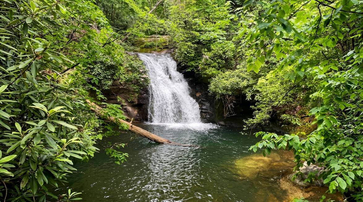
This is one of the more rewarding “hidden gem” waterfall hikes near Helen. The road in is a rough forest road that keeps casual visitors away, but the payoff is two separate waterfalls and one of the prettiest pools in the region, known locally as the Blue Hole.
- Rating: 4.8 stars (840 reviews)
- Distance: about 2.5 miles round-trip
- Difficulty: moderate (some elevation and creek crossings)
- Address: 1333 Indian Grave Gap Rd, Hiawassee, GA 30546
- Vehicle: high clearance strongly recommended for the access road
View High Shoals Falls on Google Maps
Tallulah Gorge State Park
Tallulah Gorge is about an hour east of Helen and worth the drive. The gorge is nearly 1,000 feet deep and two miles long, with a suspension bridge that swings above the river and a rim trail that gives you five different waterfall overlooks. Serious hikers can apply for a gorge floor permit (limited daily) to descend all the way down.
- Rating: 4.8 stars (6,718 reviews)
- Distance: 1 to 4+ miles depending on route
- Difficulty: easy on rim, strenuous on gorge floor
- Address: 338 Jane Hurt Yarn Rd, Tallulah Falls, GA 30573
- Parking fee: $5 daily
Good to know: Gorge floor permits are free but only 100 are issued per day, first-come-first-served at the interpretive center. Arrive early.
View Tallulah Gorge on Google Maps

Tips for a Great Hike in North Georgia
We have hiked all of these trails at every time of year, and a few small habits make a big difference to how the day goes.
- Check trail conditions before you go. The Chattahoochee-Oconee National Forest posts current alerts on its website. Winter storms and severe weather have left some trails with blowdowns, and forest roads sometimes close after heavy rain.
- Start early. Popular trailheads like Anna Ruby, Raven Cliff, and Amicalola fill up fast on weekends. An 8 a.m. start beats the crowds and the afternoon heat.
- Bring more water than you think you need. A liter per person for a short hike, two liters for anything over 3 miles.
- Layer up in shoulder seasons. Spring and fall mornings can be cool in the mountains, but afternoons warm up quickly.
- Watch for bears. Black bears live in the Chattahoochee National Forest. Store food properly, do not leave snacks in your car at trailheads, and give any wildlife a wide berth.
- Cell service is spotty. Download offline maps and share your planned route with someone before you head out.
- Leave no trace. Pack out everything you bring in, stay on marked trails, and let wildflowers stay where they are.
When to Hike in North Georgia
Each season has its own personality up here. Here is how we usually plan around it.
Spring (March to May): Wildflowers peak in April, waterfalls run full, and temperatures are perfect for longer summit hikes. Expect some muddy sections after storms.
Summer (June to August): Hot and humid in the valleys, but the higher elevations stay cooler. Waterfall hikes are perfect for the shade and cool spray. Start early to beat afternoon thunderstorms.
Fall (September to November): Peak foliage usually lands in the third and fourth weeks of October at higher elevations, later in the valleys. This is the busiest hiking season for good reason. See our full Fall in Helen guide for timing tips.
Winter (December to February): Fewer crowds, dramatic bare-tree views, and occasional light snow at the summits. Carry microspikes if you plan to hike Blood Mountain or Brasstown Bald in January or February.
Ready to Hit the Trails?
North Georgia is packed with hikes for every level, from short paved loops to challenging summits with skyline views. The mountains, waterfalls, and forests here have a way of resetting whatever needs resetting, and we love watching guests come back from the trail with that quiet, happy look on their faces.
If you are ready to plan a hiking trip, we would love to host you. Come stay with us at Blue Creek Cabins, wake up to a mountain view, and be at the trailhead before the crowds. Explore our full lineup of cabin rentals in Helen, GA and start planning your escape today. We bring nature to you, and the trails do the rest.

Frequently Asked Questions
What is the best hiking trail in North Georgia for beginners?
Anna Ruby Falls is the top pick for beginners. It is short, paved, and ends at a beautiful double waterfall. Helton Creek Falls and the Bottoms Loop Trail at Unicoi State Park are also easy and rewarding.
Are there any easy hikes in North Georgia with waterfalls?
Yes. Anna Ruby Falls (0.9 miles), Helton Creek Falls (under 1 mile), and Dukes Creek Falls (2 miles round-trip) all lead to major waterfalls with minimal effort. DeSoto Falls at 2.2 miles is another great option.
Do you need a permit to hike in the Chattahoochee National Forest?
No permit is needed for standard day hiking. Some recreation areas charge a small parking fee, and America the Beautiful passes are accepted at trailheads like Raven Cliff Falls and Anna Ruby Falls.
When is the best time to hike in North Georgia?
Late September through early November is the most popular season for fall foliage and cool temperatures. Spring (April to May) is a close second for wildflowers and full-flowing waterfalls. Both are excellent.
Are dogs allowed on North Georgia hiking trails?
Most trails on public land allow dogs on a 6-foot leash. Great dog-friendly options include DeSoto Falls, Helton Creek Falls, Dukes Creek Falls, and the trails at Unicoi and Smithgall Woods State Parks.
How far are the best hiking trails from Helen, GA?
Most of the top waterfall and summit hikes are within a 30 to 45 minute drive of downtown Helen. Anna Ruby Falls, Smithgall Woods, and Unicoi are less than 10 minutes away.
